Geography

How do you define Cascadia? New poll!

How do you define Cascadia? New poll!

When discussing Cascadia, there's almost nothing as contentious as discussing the proposed borders. Should it defined simply by the bioregion and environmental features? Washington, British Columbia and Oregon? Surrounding regions and counties? Or a mix of political, cultural, economic and geography all blurred together? 

Make your opinion heard at https://www.surveymonkey.com/s/KRTZXML

The way our money moves: Cascadia defined by regional economy

cascadiausallmap

In a recent article published on Facts CoExist theoretical physicist Dirk Brockmann argues that state boundaries are often arbitrary and out of date, no longer representative of how we communicate or function as a modern society. By tracking dollar bills he has created a series of maps redrawing state borders by how our money moves, which more accurately portrays distinctive areas based on regional economy.

When mapped in this fashion, Cascadia once again emerges, clearly delineated along a bioregional line.

cascadiamapseattle

Analyzing data from millions of single dollars, using information provided by the WheresGeorge.com project, Brockmann determined that state boundaries no longer correlate with how we move or communicate with each other. WheresGeorge.com is a grassroots money tracking group in which users enter zip codes and serial numbers of dollar bills, stamping each one so that when other users find it, it can be relogged. Each time this happens, users receive a hit, the top ‘Georger’ at the moment being an ammunition dealer who has logged more than two million bills, with roughly 500,000 hits.

Brockmann took the data for how the dollar bills traveled, and used network theory to draw lines where dollar bills are less likely to cross. The resulting map shows how "effective communities" don’t necessarily follow state lines.

This research continues to build on a wide range of data visualizations that support the idea of Cascadia as socially, linguistically, economically, environmentally and politically distinct from surrounding regions. The work builds on research released in December by MIT Senseable Cities Lab who working with AT&T defined regions based on who people communicate with, through social media and via telephone.

Cascadia Megaregion MapThe result findings are also very similar to what the federal policy and planning organization America 2050 has argued, defining roughly 11 megaregions in the United States. America 2050 is Regional Plan Association’s national infrastructure planning and policy program, providing leadership on a broad range of transportation, sustainability, and economic-development issues impacting America’s growth in the 21st century. Investigating these social interactions reveals interesting patterns for how people utilize space, and more than that, interact not only within that space, but with society at large, between neighborhood, city, county, state and region, defining what community really means in 21st century America.

In this newly regional model, cities play an important role, helping to pull nearby counties into their radius of influence, create commuting patterns, influence economic and environmental landscapes, and when they overlap, combine to create a new form of spatial geography and interaction known in the Pacific Northwest as the Cascadia Megaregion, defined as an area where “boundaries begin to blur, creating a new scale of geography”. These areas have interlocking economic systems, shared natural resources and ecosystems, and common transportation systems link these population centers together. In the Pacific Northwest, the Cascadia megaregion contains 17% of Cascadian land mass, but more than 80% of the Cascadian population.

These arguments also help to strengthen the idea that while we here in the Pacific Northwest are a part of very large countries, the United States and Canada, we still possess distinct cultural elements – language, literature, affiliations, communications – and an awareness of ourselves as members of a community which extends throughout our region, rendering many traditional boundaries obsolete and irrelevant.

Cascadia: New Art Exhibit in British Columbia

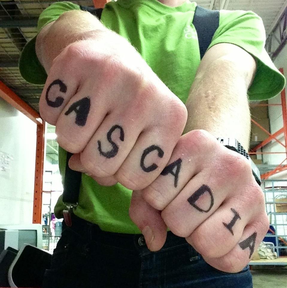
Cascadia, a new exhibition, will be running from January 24th to March 31st at The Reach Gallery Museum in Abbotsford, British Columbia. The show explores diverse art practices of visual artists from various regions in the Northwest Coast who are examining and exploring diverse concepts of the landscape (rural and urban) as well as social, cultural and political issues from a Pacific Northwest perspective.  These artists provoke a re-imaging of a specific social, cultural and political landscape to establish a dialogue between artists living in different place addressing different audiences as well as one another and demarcating zones of cultural production.

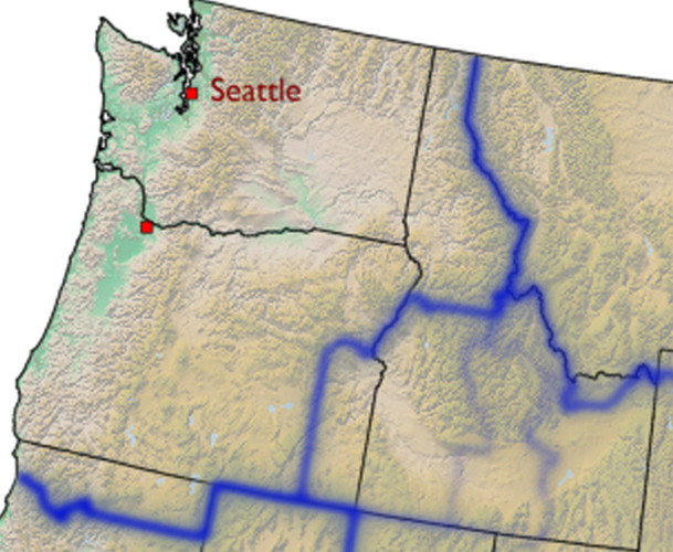
One of the objectives of Cascadia is to establish a dialogue between visual artists from Washington, British Columbia, Alaska and the Yukon and explore the similarities and difference of art practices from those specific regions.  Cascadia is a visual framework in which diverse artistic points of view are initiated and new dialogues multi-media art works mediate between artists and cultures on North America’s Pacific North Coast.

"Cascadia... still retains a sense of self identity. This exhibition explores that identity."

Scott Mardsen, Curator.

Participating Artists

Exhibition by Marten Berkman (Yukon), Michael Brophy (Oregon), Judith Currelly (British Columbia), Owen Kydd (British Columbia) and Vanessa Renwick (Oregon)and curated by Scott Marsden.

brom04coastrangeedit

Marten Berkman's multi-media approach explores the parameters of new technologies interpreting and reflecting the landscape and offers the viewer a complex layer of meaning and relationships between the Earth and global industrial culture. His creative process challenges assumptions and dualities that provide a contemporary vehicle for sensitive relationship with the planet’s remote and “wild” places. He is a a visual artist, film maker and photographer living in Canada’s subarctic. The theme of his work is the land and our relationship with it as an industrial culture. His practice has led to explorations ranging from the manufactured spaces at the heart of our urban centres, to the wilderness of remote environments on six continents. Work with his clients and partners range from photography for Canadian Geographic magazine, HD and full dome video production for Yukon and Yukon First Nations at the Vancouver 2010 Olympics, to photography and film production for the National Film Board of Canada.

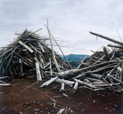
Michael Brophy's paintings make reference to and attempt to manipulate authoritative nineteenth century pictorial traditions to create critical perspectives on the contemporary social landscape of the Northwest. Brophy explores the transformation of the landscape from an idealized vision of the landscape to a contemporary examination of the relationship between landscape and power in the Pacific Northwest.  He graduated from the Pacific Northwest College of Art in Portland with a Bachelor of Fine Arts and has shown extensively in the Northwest, notably in one-person and group exhibitions in Seattle and Portland. Brophy was the subject of a mid-career survey, The Romantic Vision of Michael Brophy, organized by Tacoma Art Museum in 2005.

Judith Currelly’s paintings are inspired by the stark vastness of Northern British Columbia and the Yukon and speak about finding a relationship with Nature and the environment. It forms the basis for simplified, stylized landscapes and wildlife forms painted in a beautifully restrained palette. In her paintings, Currelly employs various tactile techniques such as scraping, scoring, bevelling and staining the surface of the wood to imply geological forms. In her printmaking, she incorporates woodblock and lino printing techniques into the paintings. Etching and scraping reflect the permanence of mark making, as they do with petroglyphs, pictographs or fossils.

Owen Kydd's photographic work investigates the pictorial intersections of photography, video and film. Kydd’s focus is urban encroachment on rural spaces in the form of strip malls, gas stations, drag-strips and fast food outlets.

Vanessa Renwick’s video work reflects an interest in place, relationships between bodies and landscapes, and borders. Working in experimental and poetic documentary forms, Renwick produces films, videos and installations that explore the possibility of hope in contemporary society.

Artists Talks

Thursday, January 24 @ 6pm: Vicky Marshall and Pat Service Friday, January 25 @ 12 noon: Michael Brophy and Vanessa Renwick Thursday, January 31 @ 7pm Brian Brett

For more information, details can be found on the Reach Gallery website at:

http://www.thereach.ca/exhibitions/upcoming-exhibitions

Cascadia Now! January Newsletter

Cascadia-Knuckle-Tats.jpg

Cascadia Knuckle TatsIn this January edition of the Cascadia Monthly:

[gview file="http://cascadianow.org/wp-content/uploads/2013/01/Cascadian012013.pdf"]

Anyone should feel free to download, print and distribute as they see fit. A big thanks to our layout editor Vickie Phelps and Adam Munson. The Cascadia Monthly newsletter is a free monthly newsletter. We have a completely open submission policy and welcome any and all articles related to Cascadia and the Pacific Northwest, though we ask that they not be politically affiliated. Articles that violate our mission statement will also likely not be included. Submit related Cascadia content, pictures, articles, events or contributions to our editor Adam Munson at

desolatesorrows@gmail.com

Previous Editions:

The Connected States of Cascadia - MIT Study Shows More Connected than Ever Before

Researchers at MIT Senseable City Lab, working with AT&T Labs and IBM Research have revealed a very nice set of data visualizations that redefines regional boundaries within the United States, using patterns of social connectedness derived from aggregated cellphone communication patterns. The project, "The Connected States of America" illustrates emerging communities defined by social interaction. The Cascadia bioregion features prominently in the illustrations, with the connections helping to better represent the social and cultural realities that are emerging in the Pacific Northwest, and the increasing fragmentation and cultural clustering currently underway throughout the rest of the country.

"Our interactions define new communities... which go beyond traditional state boundaries... with states splitting and merging together "

The data visualizations were derived from 2011 studies by looking at billions of instances of aggregated cell phone communications, working to redefine communities through the informal lens of social networks, hopefully allowing policy makers to utilize the data to increase the democratic process. Carlo Rotti, director of MIT Senseable Labs stated: "We are particularly interested in how such rich information can help us gain a better understanding of our society, which in the future, could lead to more democratic, bottom-up structures of governance."

Investigating these social interactions reveals interesting patterns for how people utilize space, and more than that, interact not only within that space, but with society at large, between neighborhood, city, county, state and region, defining what community really means in 21st century America. In this newly regional model, cities play an important role, helping to pull nearby counties into their radius of influence, create commuting patterns, influence economic and environmental landscapes, and when they overlap, combine to create a new form of spatial geography and interaction known in the Pacific Northwest as the Cascadia Megaregion.

In addition to this, working on a bioregional framework also appears to be important and researchers found that Mountain ranges and other geographic features influence how people interact, because they contribute to an increased perception of distance and therefore hinder communication.

The result findings are also very similar to what the federal policy and planning organization America 2050 has argued, defining roughly 11 megaregions in the United States. America 2050 is Regional Plan Association's national infrastructure planning and policy program, providing leadership on a broad range of transportation, sustainability, and economic-development issues impacting America's growth in the 21st century.

A megaregion is defined as an area where “boundaries begin to blur, creating a new scale of geography”. These areas have interlocking economic systems, shared natural resources and ecosystems, and common transportation systems link these population centers together. In the Pacific Northwest, the Cascadia megaregion contains 17% of Cascadian land mass, but more than 80% of the Cascadian population.

These arguments also help to strengthen the idea that while we here in the Pacific Northwest are a part of very large countries, the United States and Canada, we still possess distinct cultural elements – language, literature, affiliations, communications – and an awareness of ourselves as members of a community which extends throughout our region, rendering many traditional boundaries obsolete and irrelevant. This idea of common bonds and character – are transmitted through media, newsprint, education, sports, and at it’s base root – our individual communications on an interpersonal level.

The Pacific Northwest is unique – in North America, and in the world abroad. We continue to be connected in ways that challenge traditional modes of governance, aspiring to better ways of conceiving of community, locality, geography, and ecology.

More information can be found on the MIT website: http://senseable.mit.edu/csa/